
SALI — Spatial Answers for Land & Infrastructure
Survey-Grade RTK Geomatics | 3D Photogrammetry | Multispectral Telemetry | Thermal Audits
SALI delivers survey-grade aerial geomatics, remote sensing, and 3D spatial asset intelligence across Devon and the South West. By integrating sub-centimetre RTK photogrammetry, high-density point clouds, calibrated multispectral telemetry, and quantitative radiometric thermal sensing, we deliver CAD-ready baselines, environmental compliance records, and actionable engineering models for land agents, civil contractors, and estate managers.
Survey-Grade RTK & 3D Photogrammetry
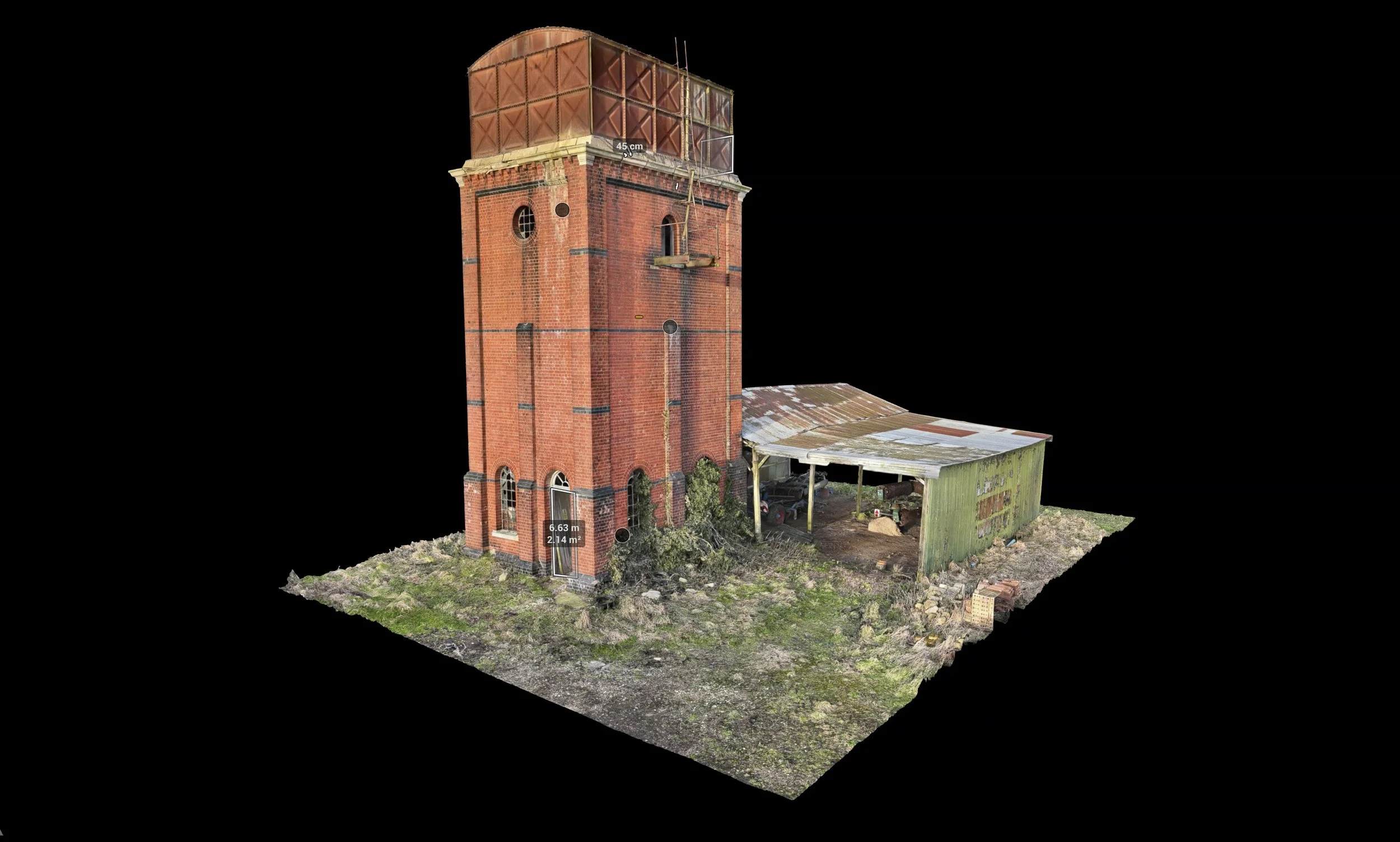
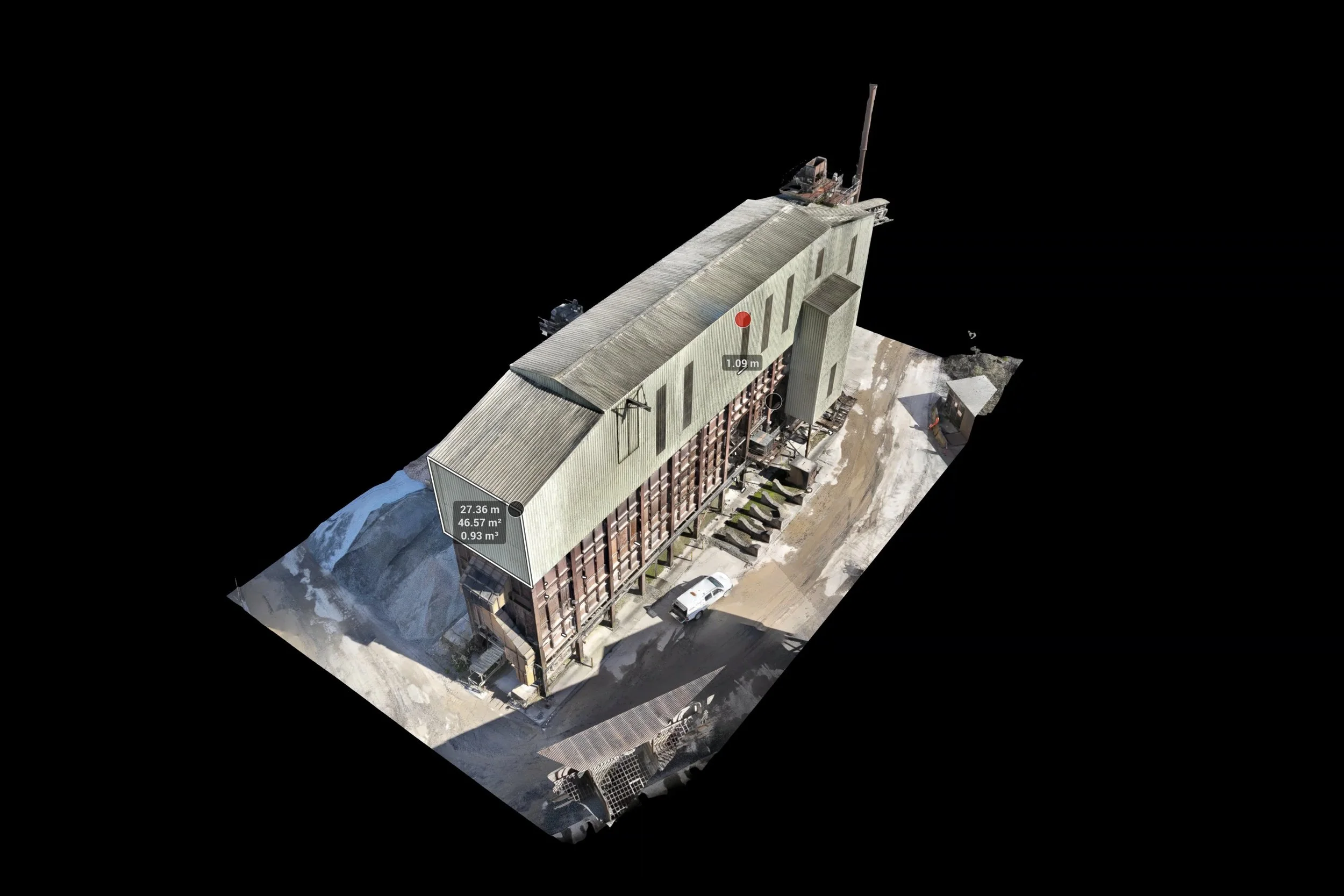
Sub-centimetre RTK photogrammetric capture, 3D point cloud generation, high-resolution 2D orthomosaics, Digital Surface/Elevation Models (DSM/DEM), 3D volumetric cut/fill calculations, and contour extraction. Formatted for direct integration into AutoCAD, QGIS, ArcGIS, and BIM environments.
Radiometric Thermal Audits & Inspection
Frequently Asked Questions & Technical Specifications:
Q: What standards and pilot credentials guide your aerial mapping operations?
A: Operations adhere strictly to UK Civil Aviation Authority standards under A2 CoC and GVC remote pilot certifications. Combined with deep domain experience in civil engineering education and construction management, every mission is executed to meet exact site engineering, safety, and spatial integrity requirements.
Q: What spatial data deliverables do you supply for civil engineering, surveying, and property?
A: We generate survey-grade 3D point clouds, digital elevation models (DEM), surface models (DSM), high-resolution orthomosaics, and CAD-ready spatial data. These outputs integrate directly into GIS platforms, BIM workflows, and civil engineering software for site planning, earthworks, and structural assessments.
Q: How does drone photogrammetry assist agricultural land management and drainage analysis in West Devon?
A: Using multi-aircraft mission capabilities—including high-accuracy RTK positioning and multispectral imaging—we deliver accessible aerial data for surface water tracking, soil drainage mapping, topography assessment, and crop health analysis to support sustainable land-management decisions across the South West.
Q: Where are your aerial mapping and spatial data services available?
A: Based in West Devon (EX20), we provide commercial aerial photogrammetry, RTK site mapping, and spatial data collection across Devon, Cornwall, and the wider South West region.
Request Technical Consultation & Site Scope
Discuss your project requirements, request sample survey datasets, or receive a site-specific scoping statement for RTK photogrammetry, multispectral mapping, or thermal inspection.
CAA Certified Remote Pilot: Operating under UK Civil Aviation Authority regulations (A2 CoC / RPL-L1).
Fully Insured: Comprehensive commercial UAV insurance compliant with EC 785/2004 requirements.
Industry Expertise: Led by construction management expertise (BSc Hons Construction Management & Environment) to align with site engineering and surveying standards.
Quantitative thermal sensing for commercial and estate roof inspections, building envelope heat loss detection, solar array diagnostic audits, water corridor leak tracing, and insulation performance reporting.
Agricultural & SFI Compliance Mapping
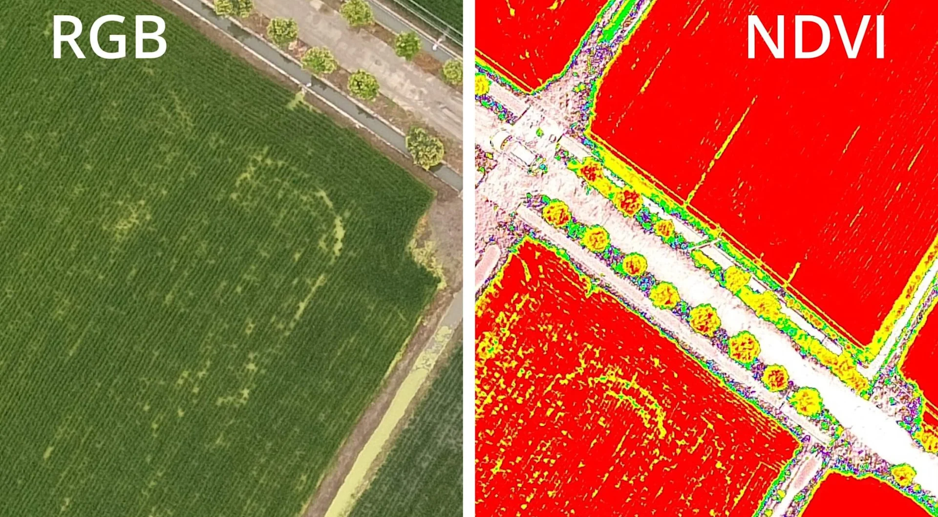
Calibrated multispectral imagery (NDVI/NDRE) for crop vigor tracking, soil variation analysis, drainage assessment, and boundary verification aligned with DEFRA, RPA, and Sustainable Farming Incentive (SFI) evidence criteria.
BNG & Ecological Asset Monitoring
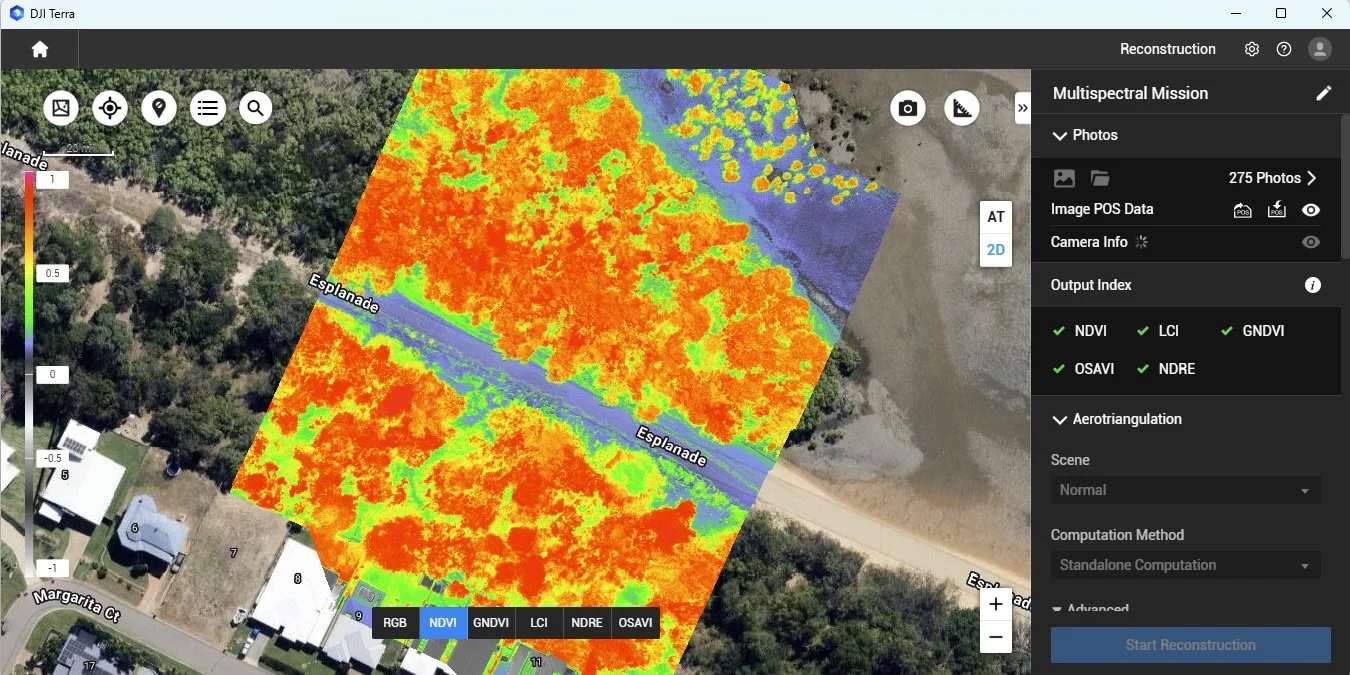
Baseline habitat surveys, tree canopy volume/height analysis, and temporal change detection to support Biodiversity Net Gain (BNG) reporting and natural capital asset valuation.
Local Roots, Institutional Rigour
SALI combines over 40 years of built-environment, geomatics, and technical education experience across Devon and the South West. Operates under CAA flight authorisations with strict air-gapped data security protocols, ensuring client telemetry, spatial assets, and CAD baselines are handled with complete institutional integrity.